 Catalogue PIGMA
D1: Biodiversité - Poissons
Type of resources
Available actions
Topics
Keywords
Contact for the resource
Provided by
Years
Formats
Representation types
Update frequencies
status
Scale
Resolution
-
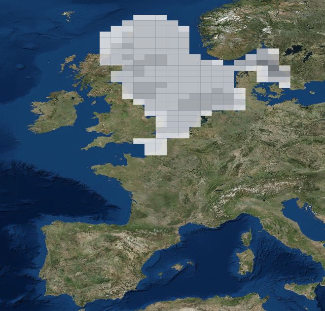
Évaluation de l’atteinte du bon état écologique des Poissons et Céphalopodes au titre du descripteur 1. Carte des campagnes halieutiques hauturières (démersales et pélagiques) conduites par l'Ifremer pour l’évaluation de l’atteinte du bon état écologique des Poissons et Céphalopodes. Cette carte a été produite pour la Synthèse. La totalité des cartes produites pour ce descripteur sont visualisables dans le Rapport et les Fiches détaillées (Liens - Accès aux données).
-
Mediterranean and Black Sea fisheries feature a great variety of target species, vessels and fishing gears and play an important socioeconomic role in the whole region. The mandate of the General Fisheries Commission for the Mediterranean (GFCM) is to ensure the sustainability of fisheries activities through the adoption of adequate management measures. The assessment of the size and state of the stocks exploited by fisheries is one of the pillars of modern management. The GFCM as the responsible Regional Fisheries Management Organisations (RFMO) of the Mediterranean and Black Sea has established permanent working groups on dermersal and small pelagic fish species where fisheries scientists perform their analysis and provide the best scientific advice to better manage fisheries and fish stocks. The groups, in cooperation with regional programs under the Regional Sea Conventions, set standards and guidelines for the collection, transmission and analysis of these data.
-
Output of the 2019 EUSeaMap broad-scale predictive model, produced by EMODnet Seabed Habitats. The extent of the mapped area includes the Mediterranean Sea, Black Sea, Baltic Sea, and areas of the North Eastern Atlantic extending from the Canary Islands in the south to the Barents Sea in the north. The map was produced using a "top-down" modelling approach using classified habitat descriptors to determine a final output habitat. Habitat descriptors differ per region but include: Biological zone Energy class Oxygen regime Salinity regime Seabed substrate Riverine input Habitat descriptors (excepting Substrate) are calculated using underlying physical data and thresholds derived from statistical analyses or expert judgement on known conditions. The model is produced using R and Arc Model Builder (10.1). The model was created using raster input layers with a cell size of 0.00104dd (roughly 100 metres). The model includes the sublittoral zone only; due to the high variability of the littoral zone, a lack of detailed substrate data and the resolution of the model, it is difficult to predict littoral habitats at this scale. This map follows the EUNIS 2007-11 classification system where it is appropriate. It has also been classified according to MSFD Benthic Broad Habitat types. This report details the methods used in the previous version (v2016) - a new report is in progress: Populus J. And Vasquez M. (Eds), 2017. EUSeaMap, a European broad-scale seabed habitat map. Ifremer Available from: http://archimer.ifremer.fr/doc/00388/49975/
-
Mapping of nursery and spawning grounds of small pelagic fish. Mediterranean Sensitive Habitats (MEDISEH)
-
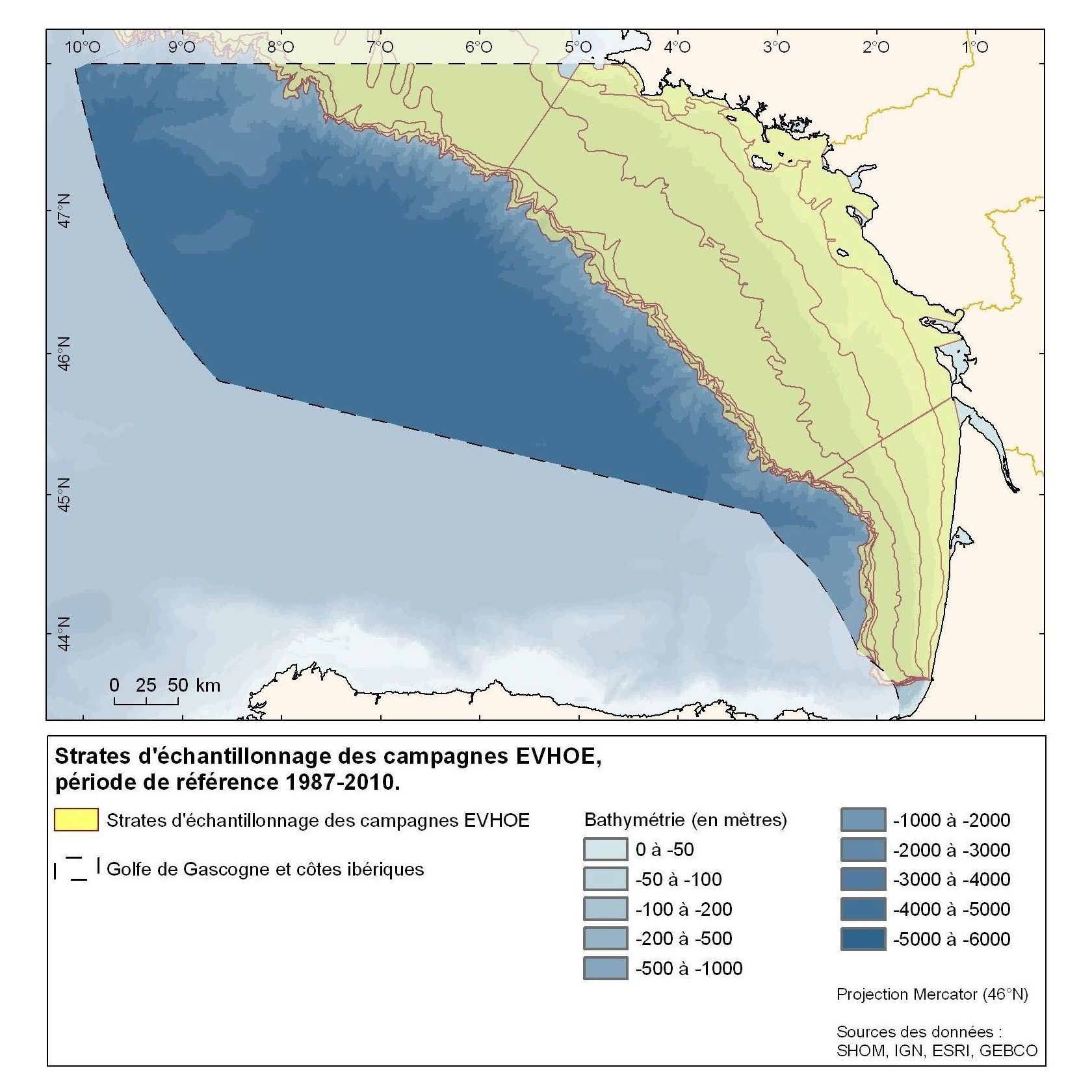
Zones couvertes par les campagnes Evhoe (1987-2010) et Medits (1994-2010)
-
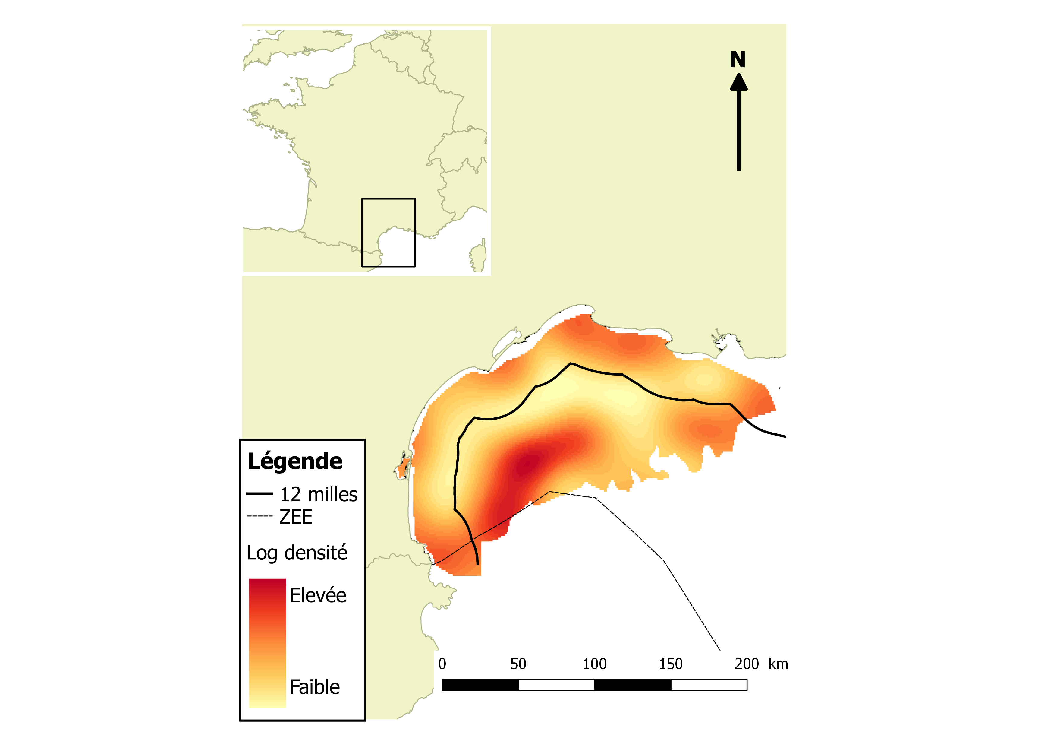
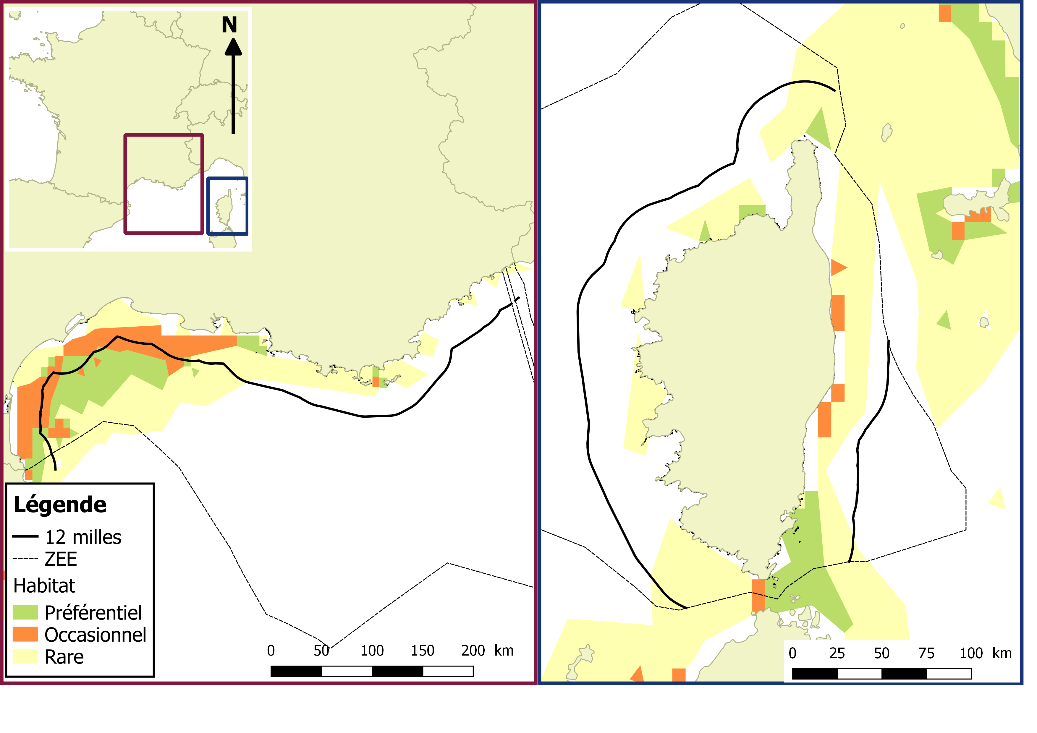
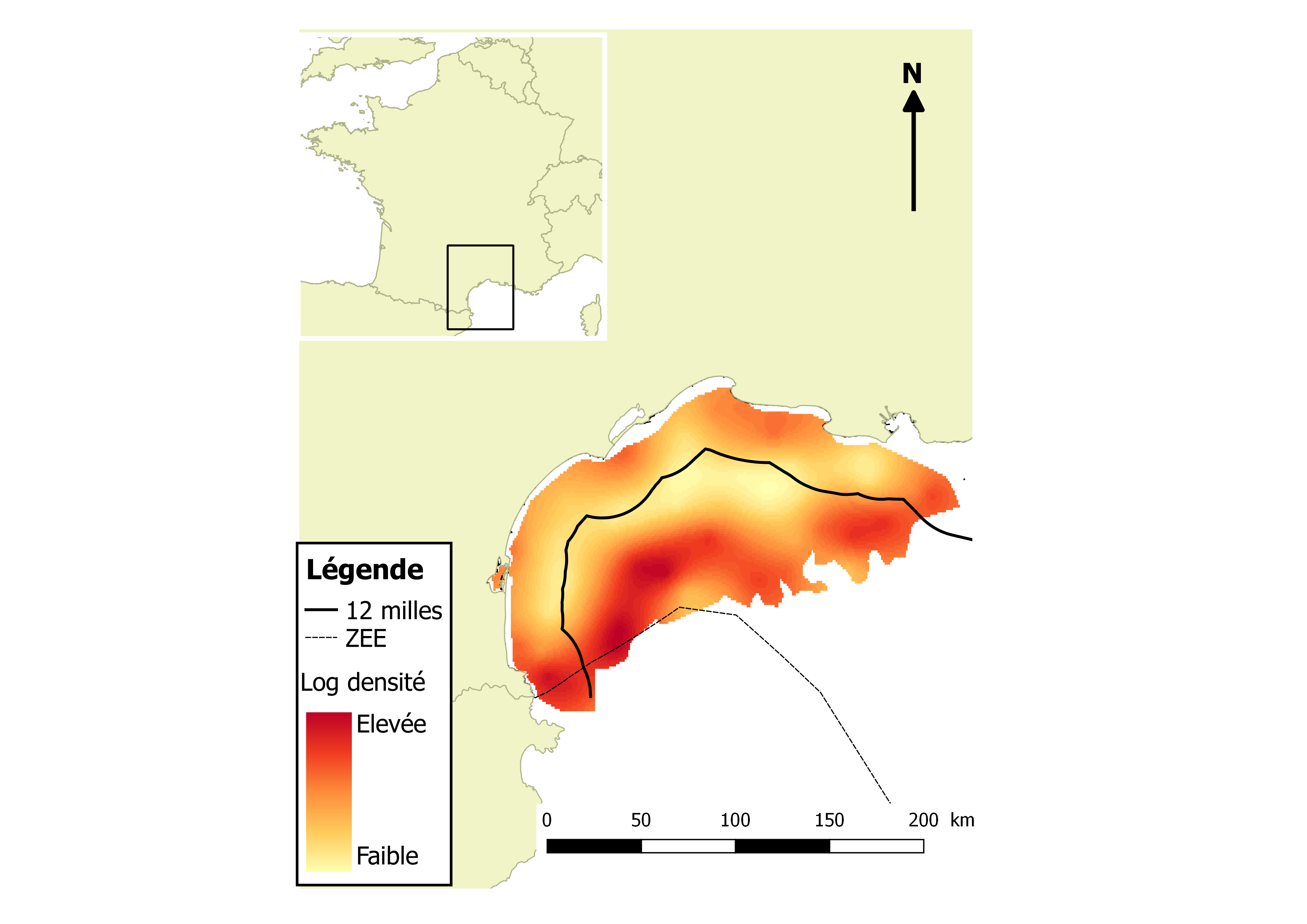
Dynamiques spatio-temporelles d'espèces démersales clés du golfe du Lion : bénéfices potentiels d’aires marines protégées. Le champ val correspondent aux log-densités, consulter le rapport associé.
-
Dynamiques spatio-temporelles d'espèces démersales clés du golfe du Lion : bénéfices potentiels d’aires marines protégées
-
Mapping of nursery and spawning grounds of small pelagic fish. Mediterranean Sensitive Habitats (MEDISEH)
-
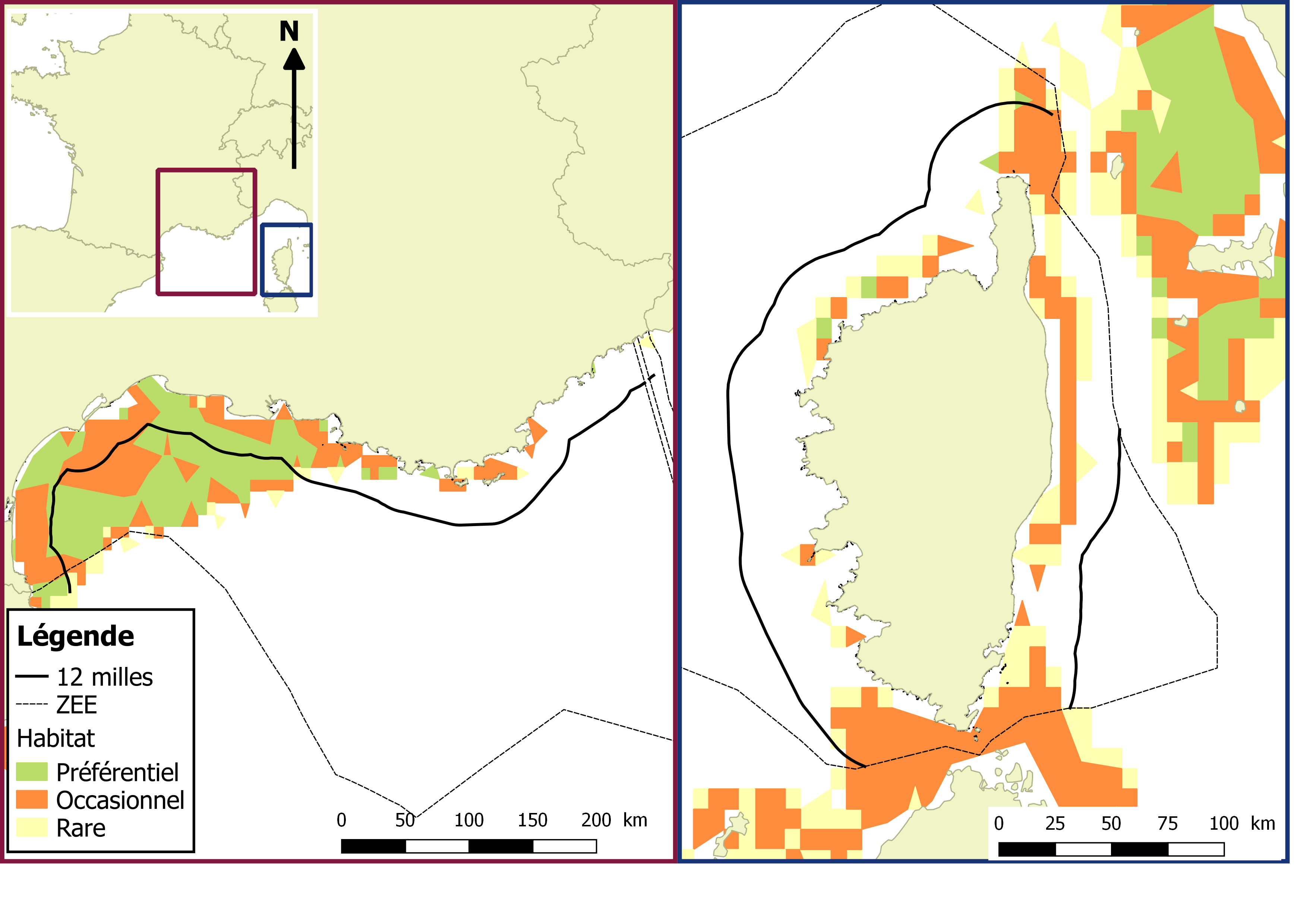
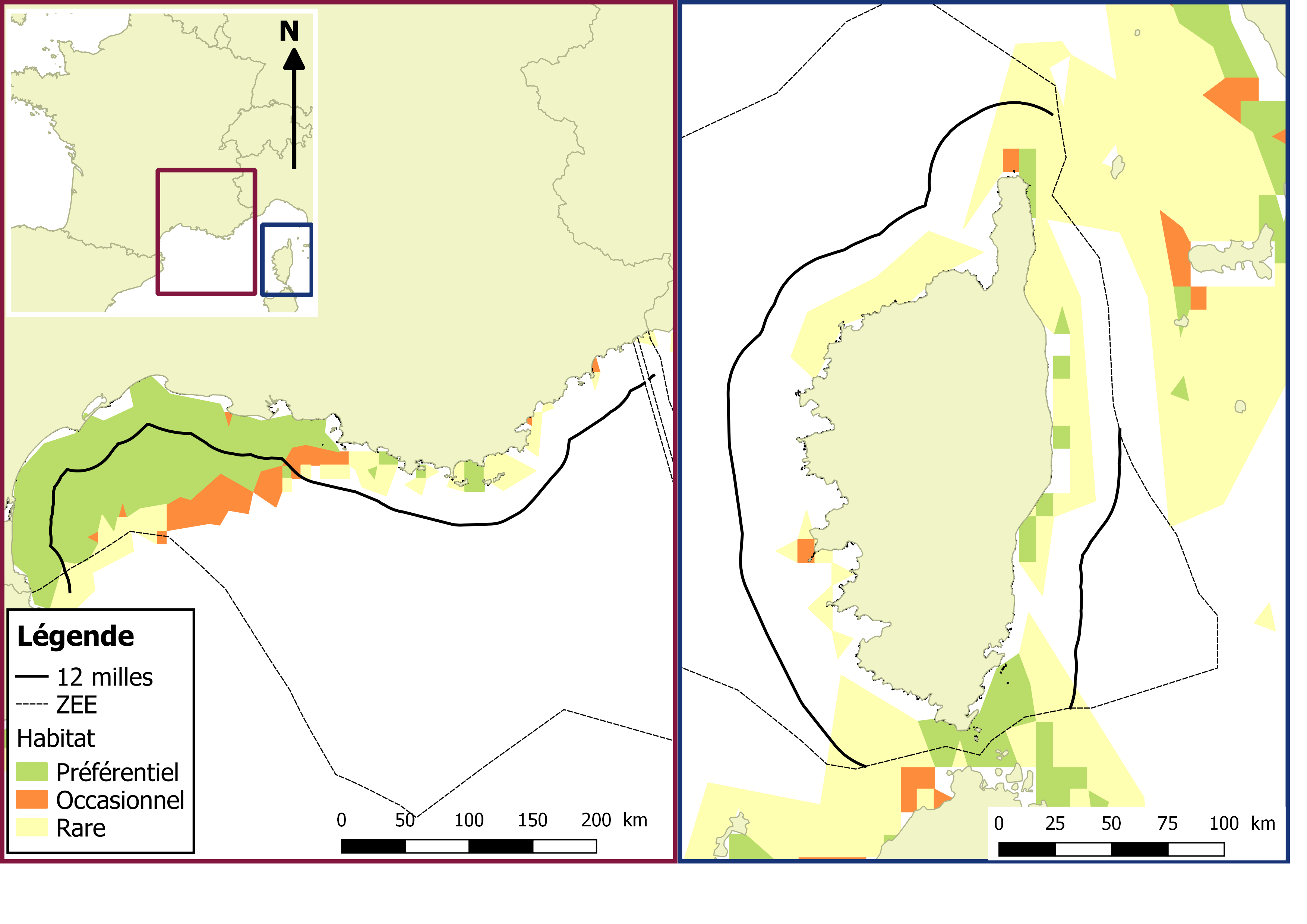
Mapping of nursery and spawning grounds of small pelagic fish. Mediterranean Sensitive Habitats (MEDISEH) Le champ val correspondent aux log-densités, consulter le rapport associé.
-
DATRAS North Sea Bottom Trawl Survey